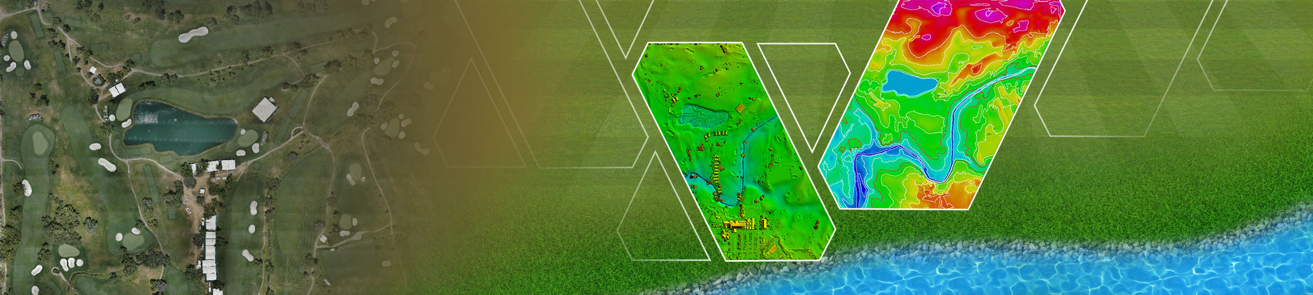
Golf Course 3D Photogrammetry Services
The design and maintenance of golf courses require precision and accuracy, especially when it comes to analyzing the terrain and creating detailed layouts. One of the most advanced technologies revolutionizing golf course mapping and design is photogrammetry. At Golf Club Graphics, a specialized division of GeoShot Technologies, we offer cutting-edge photogrammetry services tailored specifically for golf course planning, development, and renovation.
Using state-of-the-art tools and processes, we create highly accurate digital surface models (DSMs), elevation models, orthophotos, and contour maps to ensure every detail of the golf course is captured with precision. These solutions help developers, architects, and course managers make informed decisions during every phase of their project.
Our 3D Photogrammetry Services for Golf Courses
Golf Club Graphics specializes in providing a wide range of photogrammetry services for golf courses. Here’s what we offer:
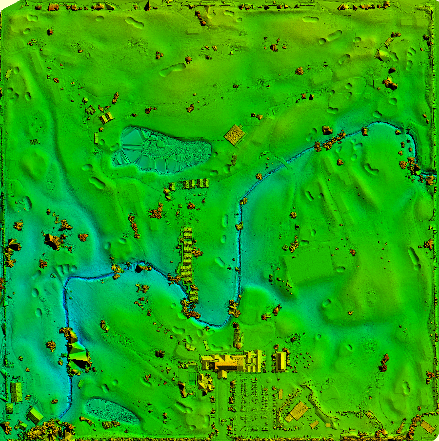
Digital Surface Model (DSM):
A digital surface model provides a detailed representation of the terrain, including all natural and man-made features such as trees, buildings, and bunkers. DSMs are essential for understanding the surface characteristics of the golf course, enabling accurate planning and design.
DEM/ DTM:
While DSMs include surface features, digital elevation models or digital terrain models offer a bare-earth view, removing obstructions like vegetation and structures. This is particularly useful for grading and drainage planning on the course.
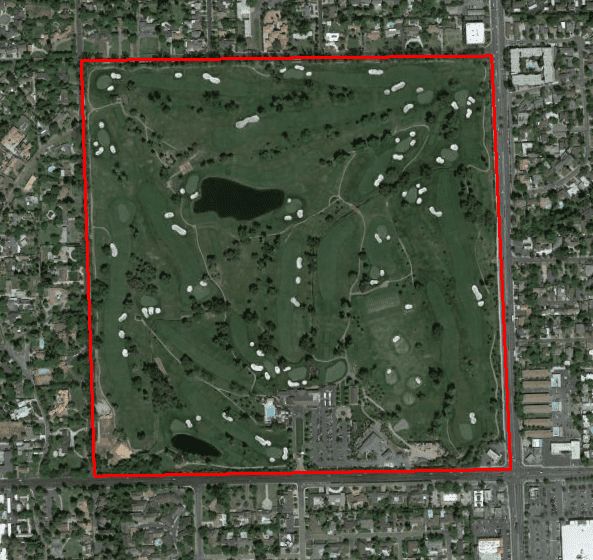
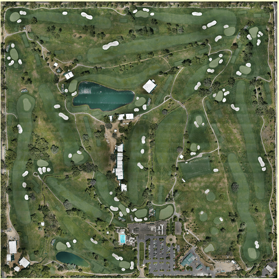
Digital Orthophoto
Orthophotos are georeferenced aerial images that provide an accurate overhead view of the golf course. These high-resolution images are corrected for distortion and are vital tools for visualizing the entire layout.
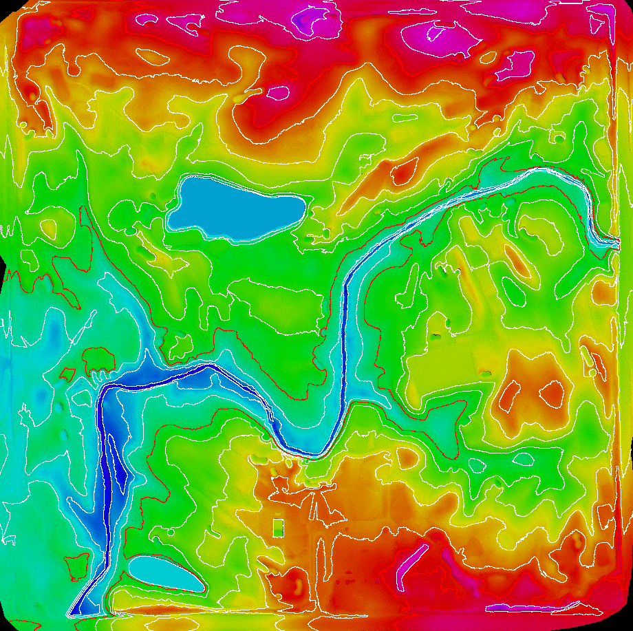
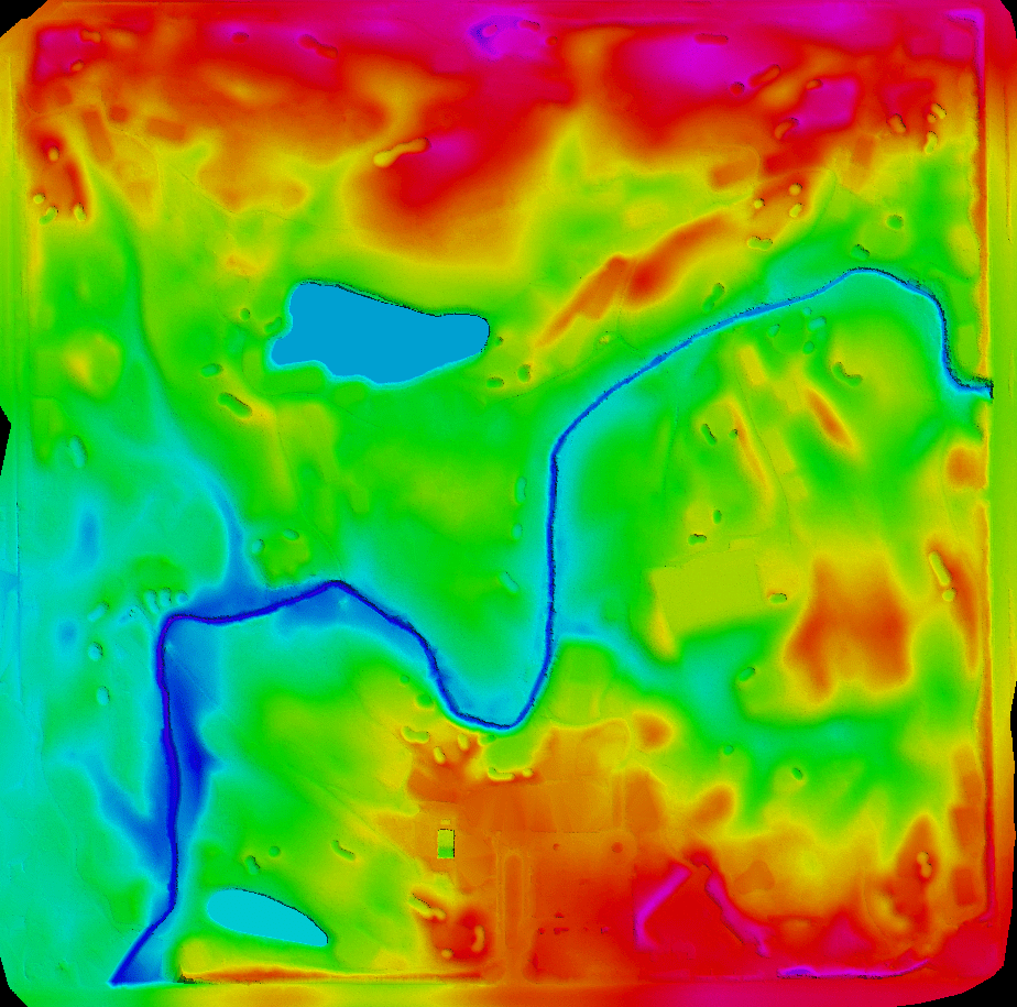
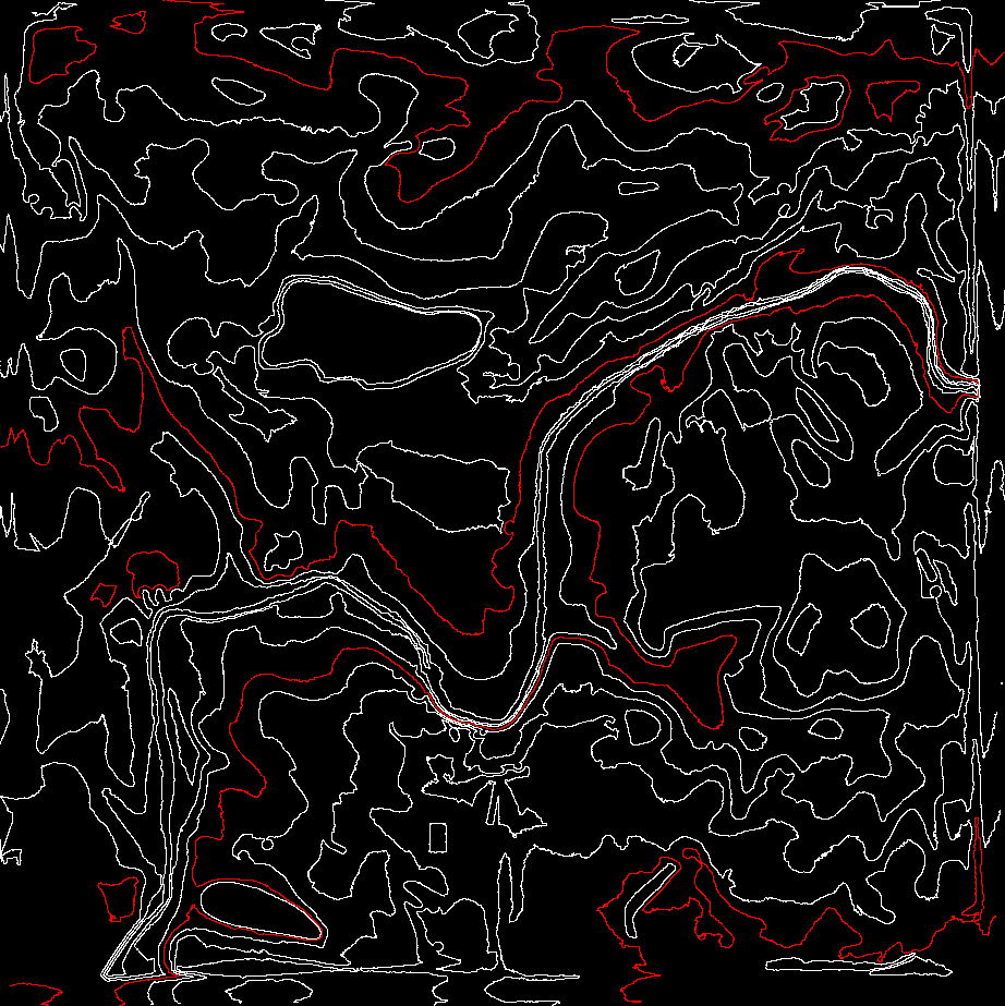
Contour Mapping
Contour maps are critical for understanding elevation changes and slopes across the golf course. These maps are generated using photogrammetry and provide detailed information for grading, landscaping, and construction.
Inputs Required for Golf Course 3D Photogrammetry
To deliver precise and accurate outputs, we require the following inputs from our clients:
- RAW Images or Point Cloud Data: These can be captured using UAVs (drones) equipped with high-resolution cameras.
- Camera Information:Details about the camera, such as focal length and sensor size, are necessary for accurate image processing.
- Ground Control Points (GCPs): GCPs are essential for georeferencing and ensuring spatial accuracy.
- Coordinate System/Projection Information: Providing the coordinate system or projection details ensures that the outputs align with the project’s spatial framework.
Applications of Digital Surface Models in Golf Courses
A digital surface model (DSM) plays a pivotal role in various aspects of golf course design and management:
- 1. Processing RAW Images: The first step involves processing the raw images captured by UAVs or other sources. This ensures the data is ready for further analysis and mapping.
- 2. Applying Projection and GCPs:We apply the projection and ground control points to georeference the processed images, ensuring spatial accuracy.
- 3. Orthophoto Generation: Using advanced software, we create digital orthophotos that provide a georeferenced and distortion-free aerial view of the golf course.
- 4. DSM Generation: A digital surface model is created to represent the terrain and its surface features accurately. This is a critical output for understanding elevation and layout.
- 5. DEM Generation: We produce digital elevation models that strip away surface features, providing a clear view of the bare earth. DEMs are particularly useful for grading and drainage design.
- 6. Contour Generation: Contours are extracted from the elevation data to create detailed contour maps. These maps are indispensable for analyzing slopes, elevation changes, and drainage patterns.
Benefits of 3D Photogrammetry for Golf Course Design
Using 3D photogrammetry in golf course design and management offers several advantages:
Enhanced Accuracy
With high-resolution data and precise georeferencing, photogrammetry delivers unmatched accuracy for terrain analysis and design.
Comprehensive Visualization
Outputs like digital surface models, orthophotos, and contour maps provide a complete and detailed view of the golf course, enabling better decision-making.
Cost-Effective Planning
By identifying potential issues early in the design process, photogrammetry reduces costly errors and rework during construction.
Time Efficiency
The use of drones and advanced processing tools significantly speeds up data collection and analysis, saving valuable time during project execution.
Eco-Friendly Solutions
With minimal disruption to the site, photogrammetry is an environmentally friendly alternative to traditional surveying methods.
Adaptability for Future Modifications
The digital data generated can be easily updated or modified, making it simple to accommodate changes or renovations in the future.
Work Process for Photogrammetry
Our photogrammetry workflow is designed to deliver precise and actionable results. Here’s an overview of our process:
- Terrain Analysis The first step involves processing the raw images captured by UAVs or other sources. This ensures the data is ready for further analysis and mapping.
- Irrigation Planning: By analyzing elevation and surface features, DSMs assist in designing efficient irrigation systems.
- Landscape Visualization: DSMs help visualize the terrain’s aesthetic appeal, enabling better landscaping decisions.
- Construction Management: Contractors can use DSMs for precise grading and earthmoving, ensuring the project stays on track and within budget.
 Chat on WhatsApp